Too Much Tech? Really ? Got Tech??? Sort Of…

Girls learn ... we can do technology, science and math with good teachers.

There was a New York Times article that spoke of too much tech in children’s life.
http://www.nytimes.com/2015/01/30/opinion/can-students-have-too-much-tech.html
It requires a careful reading. There are some very good points in the article but what is too much tech?
What is not spoken of is too little training by teachers who use what technology is available for them to use in the schools.What is not shared is that the IT person sometimes becomes just another administrator instead of a helping hand. Another layer of administration in some schools.

Many people have never achieve access, gotten adequate technology, and /or learned to integrate technology, never mind flipping the classroom.

COMPUTATIONAL THINKING

This is from a supercomputing model at TACC

If you think you can compete with visual media. think again

GOT THIS TECH?

008

Many schools do not teach geography. The resources of National Geography are vast and that means content. It’s free.There are alliances, there are projects like BioBlitz, and interactive mapping.

OK Glass!!

OK Glass!!

MapMaker Interactive

http://mapmaker.education.nationalgeographic.com/?ar_a=1&b=1&ls=000000000000

An interactive mapping experience with rich layers of information on the physical Earth, oceans, culture, and more.

http://education.nationalgeographic.com/education/?ar_a=1

GOT SCIENCE ON A SPHERE?

https://upload.wikimedia.org/wikipedia/commons/c/cc/Esrl4_072009.jpg

Have You Got This Tech? Cyberlearning?

The NSF 2015 Teaching and Learning Video Showcase: Improving Science, Math, Engineering Computer Science, and Technology K-12 showcases cutting-edge NSF-funded work to improve teaching and learning, and will allow colleagues affiliated with MSPnet, CADRE, CIRCL, CAISE, STELAR, CS10Kcommunity, and ARC to view, discuss, and comment on each others’ work.

It will also allow each project to disseminate their work to the public at large, helping NSF achieve its goal of broad dissemination of innovative work. All videos and discussions will be archived for future access.

The 2015 Teacher and Learning Video Showcase is available from the
http://resourcecenters2015.videohall.com

112 (3-minute) videos from innovative project work conducted by researchers in multiple NSF programs.
http://resourcecenters2015.videohall.com
Over 260 presenters and co-presenters have submitted 112 videos

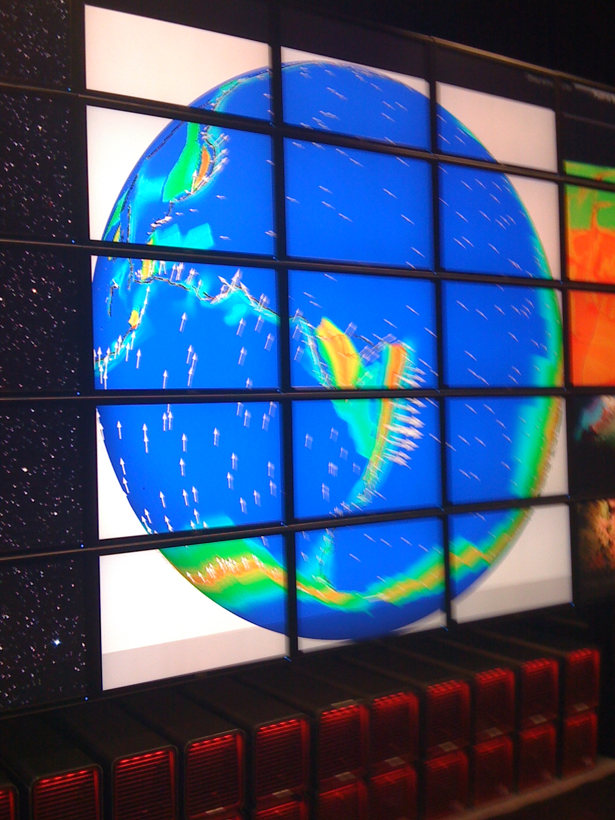
Do You Know Supercomputing? Most teachers don’t..Some have resources that have been developed for their use in Cyberlearning and in various programs from the National Center for Supercomputing Applications.

GOT SUPERCOMPUTING? Visualization and Modeling? Big Data?

IMG_0078

Some of us were lucky enough to be a part of the Christa McAuliffe Institute, i.e. there were two groups of us who worked together through the NEA. We seized the ideas of minority technology, and attempted to share what we knew about technology teacher to teacher and region to region. We were minority, male and mostly female and we did workshops and initiatives all over the USA.

The five first chosen were called Christa McAuliffe Educators and we were trained, given professional development with the latest of tools and the best of professors over many months.( Chris Dede and Seymour Papert. and there were others).Yvonne Andres shared Fred Mail, and we also learned from NASA and the National Center for Supercomputing. It was radical at the time.
We did some special programs with the NSF and learned about their outreach as well.

Being involved in transformational education through NASA

We never mentioned the word Supercomputing, we just did it.

At the time there were many NASA programs . We had people who demonstrated astronomy from the Hubble Space Telescope and the Young Astronaut Program.

http://www.nasa.gov/mission_pages/hubble/main/index.html

Challenger Center for Space Science Education is a nonprofit educational organization with its headquarters in Washington, DC. It was founded in 1986 by the families of the astronauts who died in the Space Shuttle Challenger disaster on January 28, 1986.

The organization offers dynamic, hands-on exploration and discovery opportunities to students around the world. These programs equip students with the knowledge, confidence, and skills that will help better our national social and economic well-being.http://www.challenger.org

There was also Space Camp . If you look at the information in the link even back then there was awesome tech.

Space Camp was the brainchild of rocket scientist, Dr. Wernher von Braun. Von Braun led propulsion activities that launched the Apollo-era U.S. manned space program and envisioned an aggressive schedule for America’s space-bound pioneers. Von Braun, then director of the NASA Marshall Space Flight Center, reasoned there should be an experience for young people who were excited about space. Under the guidance of Edward O. Buckbee, the first director of the U.S. Space & Rocket Center, Space Camp was born.

Camps are available for fourth grade through high school-age students. Additional programs are offered for trainees who are blind or visually impaired, deaf or hard of hearing and those who have other special needs. Space Camp programs are also available for adults, educators, corporate groups and families. Family programs may include children as young as seven years old. I can’t really list all of the programs then or now. Space Centers helped us to find all of the projects that were available. Some teachers did Moonbase America, and others did project based NASA projects. We learned about raising food in space, basil, tomatoes, and thinking about ways to raise tilapia.

Being a Science Teacher with Outside Resources.. Try these NASA resources !!
We created an institute at Stanford where we invited teachers who applied to share their technology. We also presented our special projects. It was a sharing of the best of the best. We created more ways in which to do STEM which was called at the time SMET.

That is one level of technology. Have you considered that there was a synergy of space and Star Wars? The movie propelled a lot to be interested in Science Fiction. The force of interest drove many students to robotics.

Many Children Have Parents to Share New Ways of Learning with Them

This is from Family Days at AAAS.

George Lucas also pioneered Edutopia.Technology Integration examples were shared to help us all
explore new tools and strategies for empowering students to fully participate in a connected, techology-rich society. But this is the problem. At the time we talked of the digital divide. That was before a lot of people had access, tools, training, and/or permission to use technology in schools.

There was not BYOT Bring your own technology , and even with the tools we had there was a content divide. I know that in rural, distant , urban and some tribal areas we have a bigger divide.

Some people are not at the level that we think. There is a lot of tech, but it is not in all schools.

Orienteering, STEM Skills that link to GPS, and GIS… Esri Here I Come

There are all kinds of games, simulations and events that kids get to experience on devices. We looked at a simulation of the oil spill on the Ipad.

There are all kinds of games, simulations and events that kids get to experience on devices. We looked at a simulation of the oil spill on the Ipad.

Hands on a globe

Sometimes you think you know all of the answers. I have often worked with kids outside in big spaces. Purposing work in an outdoor lab I never got the connection about electronic orientation. Those girls and boys who worked with me can remember the fun we had at the Outdoor Lab. 


Today in Russian I got the feeling that I could have, with some equipment, prepared kids for a future in STEM or STEAM by adding Esri , What is GIS after teaching orienteering.

orienteering

First let’s look at orienteering.

From Wikipedia, the free encyclopedia

“Orienteering is a family of sports that requires navigational skills using a map and compass to navigate from point to point in diverse and usually unfamiliar terrain, and normally moving at speed. Participants are given a topographical map, usually a specially prepared orienteering map, which they use to find control points.[1] Originally a training exercise in land navigation for military officers, orienteering has developed many variations. Among these, the oldest and the most popular is foot orienteering. For the purposes of this article, foot orienteering serves as a point of departure for discussion of all other variations, but basically any sport that involves racing against a clock and requires navigation using a map is a type of orienteering.”

We know where we are with technology, our phones, our computers and hand held devices. I Think to gain skills that
we should involve more hands on. This training here in Samara is a year long project with two main events for the students, and sometimes an event for disabled people which is done differently. The students go to the Cacausus Mountains and camp out to do the event. It is done by boys and girls and the coaches and volunteers are men and women and

http://www.catchingfeatures.com/ is where you learn.

The game?
Catching Features is an orienteering game you can play at home. Use it for rainy-day training or rest-day enjoyment. Several different modes of play are available. Individual courses are run with interval starts against computer opponents, or with a mass start against lots of them. Relay events allow you to run one leg of a forked relay course.

Each course you run will earn you a number of ranking points based on the other runners that day. By earning more points you can unlock additional events to run.

Internet play allows for races against human opponents all over the world in real time. Race against your friends in a virtual competition! And you thought you didn’t have anything to do at work…

Can’t coordinate a multiplayer game against anyone else, but still want to compare times? Competitions mode allows you to download and run a race whenever you can, then your splits and route choice are automatically uploaded to the CF server for everyone to see and compare!

A random map generator lets you create an endless supply of maps and courses to run on. You can run on a different map every day for the next 89 years…

A map editor is included with the full version of the game. Used for editing maps and planning courses, it allows full control over terrain, vegetation (down to individual trees and rocks), objects (tables, fences, boats…) and all other aspects of the map. An OCAD file converter lets you start building CF maps from your favorite local terrain.

You can also use the included Ocad Converter to convert your library of Ocad maps into playable CF maps! Train on your home forests!

That is the simulation!!
Hear are pictures of the real thing using tools.orient

From Russia with orienteering tools.

What is GIS?
http://video.nationalgeographic.com/video/science/technology-sci/gis_journey/

A geographic information system (GIS) integrates hardware, software, and data for capturing, managing, analyzing, and displaying all forms of geographically referenced information.

GIS allows us to view, understand, question, interpret, and visualize data in many ways that reveal relationships, patterns, and trends in the form of maps, globes, reports, and charts.

A GIS helps you answer questions and solve problems by looking at your data in a way that is quickly understood and easily shared.

Map Your Passion. Transform Our World.

We’re passionate just like you. Geography is at the heart of a more resilient and sustainable future and allows a deeper understanding of how we can positively impact the future. Together we can transform our world.

Features

Tell Your Story

Inspire action, connect with the public, and reach donors by telling your story with maps. Quickly combine location data, text, and multimedia to build interactive apps that highlight your work and advance your mission.

Monitor and Evaluate

Manage your operations, examine their efficiency, and provide transparency to donors. GIS provides operational awareness throughout your organization and analytics that support your decisions.

Collaborate with Others

Share your maps and data on your web pages, blogs, social media, and custom apps. ArcGIS Online gives you an easy-to-use and intuitive workspace for collaborating with others inside and outside your organization.

From Edutopia

Student Work: Street-Tree Inventory
Luis and his peers in the 4-H Tech Wizards program used personal digital assistants (PDAs) and geographic information system (GIS) technology to collect tree data and generate computerized maps for the City of Hillsboro Planning Department.
http://www.edutopia.org/digital-generation-technology-data-mapping

Passport to the World, Geography! Are you Up to Date?

On the Great Wall

No one has ever described the Great Wall in the media to my satisfaction

There are children who do not know the intersection of geography, history, story and maps.

Actually there are lots of people reporting the news to us from various media platforms who have little in the way of geography education or real knowledge. It is a national shane.

There is a tool that we can all use at http://www.mywonderfulworld.org.

There are resources for teachers that are incredibly wonderful at the National Geographic Society.

There are also alliances, that you can join in your state. The alliancesare here.. More resources are here. Resources

The Alliances

Geography Education Alliances connect K-12 teachers with university faculty, offering professional development opportunities and promoting improvements in geographic education at state and local levels.( http://education.nationalgeographic.com/education/program/geography-alliances/) The alliances breakj the silos of education , you have the professors, researchers, professional photographers, teachers , all working for change in a state. The resources and the opportunities are many.. My principal joined the alliance and went to some conferences with me.  I love going to Geographic conferences. They are an experience to learn a LOT from.!!! Geography is an adventure.

Vendor solutions for Geography? Well there is a lot that is free on the National Geographic Education site.

Classroom materials have been developed by geographers and geographic educators to teach the field as a discipline rather than through fact and recall. I was lucky enough to be a geographic educator a teacher, before technology called me to national service with the White House for a long term initiative. NIIAC.

Cast the students as researchers who use geography to solve real world problems. Each activity:introduces a skill for analyzing data geographically provides information about a specific place employs a specific kind of map (isoline, choropleth, profile, etc., illustrates a useful explanatory theory of modern geography. What is geography? See this cartoon for a visual definition

The 21st Century Partnership has added geography to their skills bank.

Here is a philosophical discussion about geography. Title:

Reconceptualizing Geography as Democratic Global Citizenship Education

Find the reference here in a PDF

(Bednarz, 2002)

Teaching geography in this manner is far better than didactic traditions if one values critical thinking and the development of transferable student insight about spatiality. Yet this still falls short of what we have described as democratic citizenship education.

As a teacher, I was lucky enough to be involved in a National Summer Workshop from the National Geographic Society. I was teaching in Virginia and there was a great Alliance that I was able to learn from and work with. My mentor was killed in the (/11 crash at the Pentagon. They were taking students to a meeting in California. The Virginia Geographic Alliance was a rich resource for me and other teachers.

History can be boring, but not if you use the resources available to make it real. GIS, GPS, Stories and pictures , the Internet and You Tube, enhance a lot of what you THINK you know.

In reality do you know place geography? Interactive Maps?

What is Geography?

Children, parents and the media audience see the world without really knowing much about the cuture of the groups that we talk about. A real friend of mine has NO understanding of the cultures that are in the Middle East. He told me that “we” liberated Arab women? I was too challenged to peacefully explain that he did not know the culture to reply. I think that also such misconceptions are best solved by the person with the misunderstanding. But what would lead him to such a misunderstanding. What does he read? What did he learn? What is his guide to the world? Perhaps some one of the many media minute mavens. Those reading the scripts on TV. often have no geographical idea of where the place is that they are talking about.

Maps. Maps. Maps. are here.

I like the articles that talk about geography education. Many school systems do not use geography as a subject of interest, because it is not tested. It may be offered after the fact. That is because of the politics of education, and the lack of knowledge of those with the power to make a difference in real world education.

My husband and I have traveled to many places in the world. Vic has lived in Africa, and started his career teaching English as a foreign language in Africa. His parents were missionaries to China,

I have lived in Greece. I thought I knew Greek History and the literature. I thought I did. I only touched the surface of the information available at the time. I loved living in Athens, and studying various elements of the Greek History. I particularly loved the  studying in the museum in Thessalonki, Greece.

All Roads Lead to Rome

I started my world ttravels late, on a Fulbright to India . Travel experiences, seeing your own country from afar are also quite an education. You can believe we have some very interesting discussions in our household about various elements of culture in the places we have lived and worked.

Earthwatch was a project related to something I was doing in the geographic. It was my first scientific study sponsored , to learn archaeology , of the Beaker people. But what little real history of the area of the Med did I have. Not much. That experience was eye opening to me.

But the definition geo-literacy probably is best for us in a media centric world. You will love the visualization of the topic on the page. You might also like the longer definition and explanations by Dr. Danny Edelson Photo: Daniel Edelson.

A geo-literate population can make far-reaching decisions about their health, their environment, and their community.

http://education.nationalgeographic.com/education/geoliteracy/?ar_a=1&ar_r=1

National Geographic Society Education Network www.ngsednet.org 

For updates and newletters, sign up here.

This is a beta site

http://education.nationalgeographic.com/education/programs/?ar_a=1&ar_r=1

Do you know Science on a Sphere. It is a transformative use of media to teach. It is awesome.

I was working with NTIA, NOAA, when I was pulled away from Geography as my main sphere of Interest.
NOAA is a federal agency focused on the condition of the oceans and the atmosphere. It plays several distinct roles within the Department of Commerce with a broad mission. Some of NOAA’s more widely-known divisions include the National Weather Service, The National Hurricane Center, and the National Marine Fisheries Service.

Science On a Sphere (SOS)® is a room sized, global display system that uses computers and video projectors to display planetary data onto a six foot diameter sphere, analogous to a giant animated globe. Researchers at NOAA developed Science On a Sphere® as an educational tool to help illustrate Earth System science to people of all ages. Animated images of atmospheric storms, climate change, and ocean temperature can be shown on the sphere, which is used to explain what are sometimes complex environmental processes, in a way that is simultaneously intuitive and captivating.

Science On a Sphere® extends NOAA’s educational program goals, which are designed to increase public understanding of the environment. Using NOAA’s collective experience and knowledge of the Earth’s land, oceans, and atmosphere, NOAA uses Science On a Sphere® as an instrument to enhance informal educational programs in science centers, universities, and museums across the country. Science On a Sphere® is available to any institution and is currently in operation at a number of facilities in the US.

See if you can get a kid to move, when there is this exhibit to learn from. It is mostly in museums or may be coming to a conference near you.

FInally, the 21st Century Partnership now shares the ideas of geography, and they have involved schools in the blueprint. Here is their set of resources.

   Games in Education , yes, yes and yes,

Featured Games

  • Photo: A screen from the games Lost Chronicles-Fall of Caesar, showing Brutus walking through an ornate hall

    Lost Chronicles: Fall of Caesar

    Reveal the conspiracy behind Caesar’s murder in this hidden object investigation. Meet historical figures, including Marc Antony, and learn of their role in the conspiracy.  Explore historically-detailed locations in Rome and Greece, searching for clues, as you follow the path of Marcus Brutus after he murdered Caesar.  Play various mini-games, puzzles, and more, and access informative articles courtesy of National Geographic in this compelling game.


  • salem-game.jpg

    Lost Chronicles of Salem

    Help a mother and daughter who have been accused of witchcraft escape superstitious mobs in this captivating hidden object thriller. Explore 1692 Salem in richly detailed screens, and play mini-games like word jumbles, puzzles, and more.


  • Photo:  A photo montage of migrating animals--zebras, crabs, butterflies

    Great Migrations

    Based on the breathtaking National Geographic Channel miniseries Great Migrations, this game challenges you to protect and guide your animals on their dangerous migration journeys. Select a leader, collect your herd, evade predators, and heal all wounds!


  • Photo: Logo of the game Build It Green--Back to the Beach

    Build It Green: Back to the Beach

    You love this tropical island, and now it is up to you to protect it and everything around it. Build it green

    I cannot share everything that is of the National Geographic. Go to the home page, sign up, sign in and get working.

    Bonnie Bracey Sutton

    Victor Sutton

    PowerofUs