Technology Bites Back Sometimes.. Who decides what is STEM and what expectations should we have for teachers using technology?

I am glad I am mentoring teachers for technology use with a solution for their technology problems. The online course that I decided to take after reading posts on the ECTC Journal was a wrong turn that I took recently. I went in unprepared to be found wanting.

ETC Journal

A journal for educational technology & change has great articles and so I was convinced I needed to make sure my technology was up to date.

Because I am not currently taking a course and did not go to ISTE, I decided to re-up my skills by taking the Certification Course for the National Geographic. It’s new, it’s different and I have been working with the National Geographic for a long time. Who could have predicted that I would be found wanting? But let me explain. There is a new technical divide and I could not qualify.

Here is the course National Geographic Educator Certification and it is a good one. You meet international people and explorers and you have a group of people who support you in your work. I am working in a community based organization with nothing but my laptop and tools and my intent was to start new technologies and inspire kids with all of the resources that National Geographic has to offer. I ran into a technical divide.

Who knew that some of the course was misleading?I do videos of field trips on the way back from the field trips. I used Google Glass to make a video for a school in Russia when I was working in exchange. So listening to the cohorts and viewing the expectations, I surely did not worry. They passed off the video as a minor kind of thing. But what they referenced as tools to work with . ouch!!!

Here is what they said…

Bringing it All Together: Teaching About the World

“At National Geographic, we believe that a well-rounded education provides young people with the knowledge of how the human and natural worlds work at local, regional, and global scales. This type of education also teaches young people to use different perspectives to understand the world.”

So I jumped at it. The course was beautiful until I got to the Capstone part. If there had been a real person or a time when you were face to face with a mentor I would not have failed. I believed them when they said that creating a video was not a big deal. It was a big deal. It was a painful learning process which I learned. Relearned , relearned, relearned..until I got tired.

They said “
We know that for many of you this will be your first experience creating, editing, and sharing your work in video format. Not to worry: most certified educators made their first movie in this course! We want the certification experience to challenge and push you, and the capstone video is a compelling way to tell your story. At National Geographic we have a long history of storytelling through a variety of media, and we are excited to welcome you into the National Geographic family through this valued tradition. Just like you ask your students every day to learn something new and take risks, we hope this helps you go further in your own work as an educator, storyteller, learner, change maker, and explorer. They estimated nine hours of work/ I don’t think so.

Nowhere did it say that the tools that they suggested would cost if you published them. I worked on a Powtoon for my submission ( Free)well free until you wanted to download it. A matter of money. And the tool was not thoroughly vetted . On one browser it had voice over, on another different qualities for color , and there was always the subtle suggestion that for a fiver, they would do it for you. IMovie is excellent except it kept going dark. Why? I did not have time to find out.

When you have spent hours learning to do something and you have to pay to use it and you did not expect to.. that’s a bummer. I spent about a hundred dollars trying to make a Powtoon video. I actually made a pretty good one but I could not regulate the sound and the instructor complained.

I did not expect that. I expected a guiding question to help me know what was wrong.

So I chose another one that was suggested. Many programs, after you create have , had a paywall. ARRGH!! $210.00 and we have a Movavi Video.

Here is what I said…

I was pretty sure of my use of technology before this course. With the video I was a basket case. I had gotten used to making animated sharings and small movies on Google pictures. I struggled with the video. Why? I guess I did not know the components of what. The instructions were clear, but inside some of the offered programs were paywalls and valuable time was wasted. The video I submitted was probably not my best. I had a beautiful one on Powtoon but the sound was so loud I could not share it. I had no way , except to pay some more to get that adjusted. I used every program they listed in the course to find one that was comfortable. I did not have IT support. I wanted it to be me based, or teacher based like we often are across the digital divide. That did not work.

I stumbled through several programs and really liked a few, but paused when the paywall came up and I knew that it would be published since it was “free” One of my baby steps in creating a video is sadly available.

Things I did not do that would have made it better. I should have changed to the PC when I could not right click instead of asking what was wrong. I should have upgraded my browsers and I did. I loved the IMovie. It was awesome. But since I have toys, IPad, Mac, IPhone before this course, I used them very separately for the most part. I learned the value of integrating them into a system. I actually completed a video using IMovie, but I kept getting a dark screen from time to time. Technology mistakes gave me and everyone around me a headache. I had a friend who is the ultimate in tech support but I felt that I should be able to do it without cheating.

There were ideas offered but I saw those before I went down the video trail. MP4? I think I suggested a boot camp for video but as in education, each person has their own store and set of tools, and know how and individualized learning even with stumbles was invaluable. The journey to completion or acceptance of a certain system is personal. It helps a lot if an IT professional is in person.

I have never so believed in ISTE or GenYES.

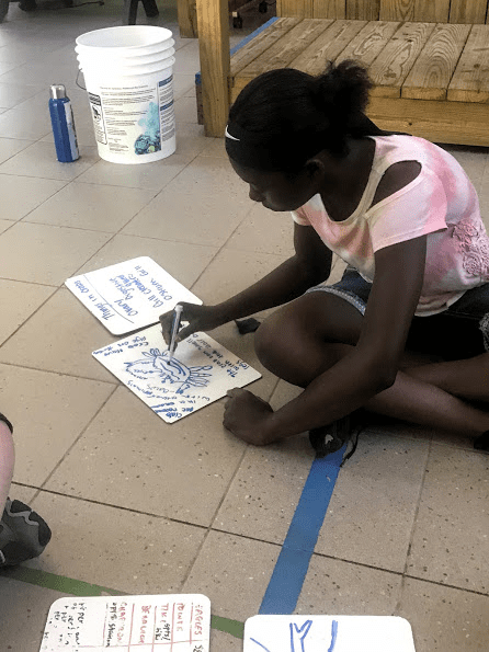
My students did outstanding work from understanding what our sources of water are our watershed, to understanding what an estuary was , to creating a watershed runoff model, to understanding global water needs and how to be a citizen scientist.

Not bad for a community activist trying to make a difference. Amount of technology where I work? Zero. At the aquarium,in ecosystems and exhibits.

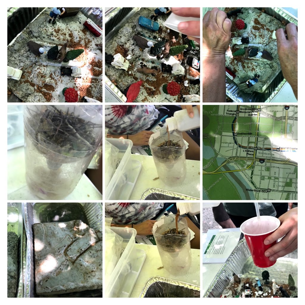
How do I know they understand run off? We made a model city and polluted it and collected the water for evaluation. See above.

We learned about the Global Impact of Water. We loved this book and the online video.

The Water Princess – YouTube

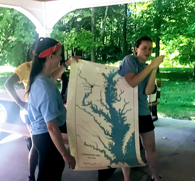
How do I know that they understand shorelines and estuary?


Where did I learn my teaching techniques, well working for the National Geographic KidsNetwork.

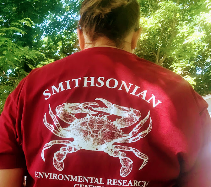
The Smithsonian Environmental Research Center was outstanding .

Here is what we did…

This program was adapted for a range of ages. It focused on science as narrative, and a collection of facts, procedures, and observations that lead to understanding the world. The guiding question of the trip was, “How do scientists tell the story of clean water, and how do people fit into that story.” We focused on science as fact based, though hands-on inquiry at each station.

Plankton/ Microscopes
Students began with a short introduction about the difference between clean water, dirty water, and treated water. They then discovered how plankton plays a role in clean and dirty water, specifically related to humans. Students were given a plankton sample and filamentous algae from the Bay, and then were asked to sort phytoplankton and zooplankton.

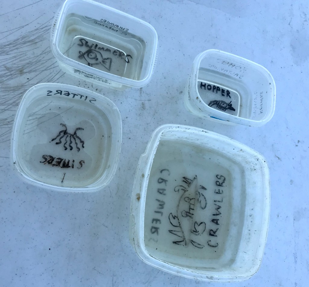
Oysters and Model Oyster Reef Sorting
Students began by exploring the different types of bivalves that live in the Bay, and then learned about how oysters live together and their biological function. They then attempted to build a model oyster reef to determine its habitat structure and then sort through a model reef that has been colonized by fish and invertebrates from the Bay. They sorted the organisms and learned about the role that oysters play in clean water and Bay habitat.
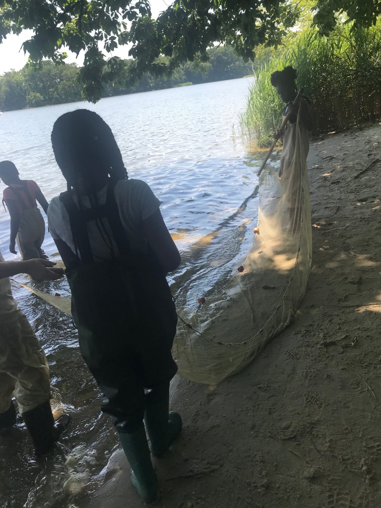
Seining
Students began by discussing how researchers might study nearshore organisms, and learn how SERC researchers use seining nets to catch fish and invertebrates. They will discuss the term “biodiversity” and how biodiversity might be an indicator of water’s health.

They then collected data by donning waders and use seining nets to sample the populations. Students concluded with a short discussion about their findings and what they might mean.  

Watersheds
Students explored how a watershed works through narrative and a 3D watershed model. They then demonstrated how material gets into and is carried through a watershed. After this they discussed how the properties of water can be described, and then demonstrated by using a secchi disc and sounding lead as well as a hydrometer.
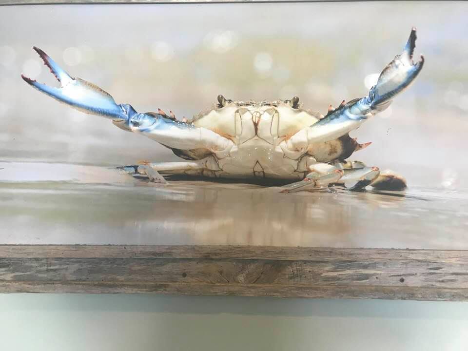
Blue Crabs
At this station students were introduced to the anatomy and biology of blue crabs. They learned about their natural history, from what they eat to when and where they migrate. Students then visited with a live blue crab and studied its anatomy and movement up close. They then finished with a short discussion about blue crab research here at SERC and look at crab pots with excluders. I had cooked crabs on ice for them to take home to eat.Eat a crab lab if you will.

Science should be inclusive, not exclusive.

I believe in the seven E’s .There are seven stages which include elicit, engage, explore, explain, elaborate, evaluate and extend.

From the River to the Sea- and Ocean Literacy


The Chesapeake Bay

cbToday, the Chesapeake yields more fish and shellfish than any other estuary in the country, close to 45,000 tons annually.  But due to increasing acidity in some parts of the bay, the shells of young oysters are growing as thick as in the past, making them easy prey for crabs.

According to a study conducted at the University of Maryland Center for Environmental Science  , acidity is increasing in some parts of the Chesapeake Bay faster than it is occurring in the open ocean.  The study should be of interest to citizen scientists.

When I was a small child, long ago, the sea was where the beach was. I had no conceptual framework of the idea of the ocean.

The science that I was taught was not the kind of science I learned about in deep kinds of learning. I went to a Catholic school and we did not have much science. I was an adult before I understood much about the Chesapeake Bay. Because of fear, and segregation we rarely visited any but the “Black” beaches.  They were not the best. So when I was a new teacher and learned a lot about water, and specifically the Chesapeake Bay; I was fascinated to learn the history of the Chesapeake Bay. The book by Michener helped to frame my ideas of the region.

My family has native American roots, so we were interested in the history of the people native to the region.

HISTORY

Back in the day, Blacks and Native Americans lived in Freetowns. ( where they were allowed to live.) That history and that of the people who helped slaves and Native Americans was interesting as well.

The storyline, like much of Michener’s work, depicts a number of characters over a long time period. Each chapter begins with a voyage which provides the foundation for the chapter plot. It starts in 1583 with American Indian tribes warring, moves through English settlers throughout the 17th century, slavery and tobacco growing, pirate attacks, the American Revolution and the Civil WarEmancipation and attempted assimilation, to the final major event being the Watergate scandal. The last voyage, a funeral, is in 1978.

http://www.amazon.com/Chesapeake-James-Michener/dp/0449211584

First I studied at the National Aquarium in Baltimore with Dr. Valerie Chase, as we created the “Living in Water” curriculum.

IntroductionProcess-Orientated Science in the ClassroomThe Hands-on Approach: What Research SaysScience process skills used in theis curriculumTeaching hands-on science

http://www.forsea.org/LIWTOC.HTML

I had a lot to learn. Before working with Dr. Chase, my science learning about the Bay was reading science. What a wonderful experience I had learning ecosystems, and adaptations and all about The first several days were headache days, because I had never heard of most of what she was talking about and I had a lot of vocabulary, ideas, and information to review.

This is their mission.
Through transforming experiences, the National Aquarium Institute inspires people to enjoy, respect, and protect the aquatic world.

But hard science became fun science. I loved the work at the Aquarium and we were in the field, and behind the scenes at the Aquarium. I treasured the learning experience and became a better teacher.

Here is the home page of the Aquarium , http://www.aqua.org/http://www.aqua.org/

You can take a virtual tour here

http://www.aqua.org/virtual-tour-baltimore/

This is important because there is a cost associated with the visit and there were parents who did not want to pay it. So the kids and I applied for grants that would make this tour a part of our learning.

Ever hear of Anoxia Mae?You do know what Anoxia is , don’t you?

Here is a history tour of Solomon’s Island

https://www.facebook.com/media/set/?set=a.470228176326.256778.593996326&type=1&l=9909fdada8

This is a tour of Wye Mills

https://www.facebook.com/media/set/?set=a.10150350735691327.396859.593996326&type=1&l=0c6755aaf9

This is an awesome place on the Rhode River.

The Learning Lab at SERC.

https://www.facebook.com/media/set/?set=a.115870491326.129996.593996326&type=1&l=48b6eab680

SERC Canoe Trip

https://www.facebook.com/media/set/?set=a.115866001326.129992.593996326&type=1

http://www.aqua.org/

Never mind that my principal was not into hands on science. I did it. It was wonderful. Parents loved the idea that we were being active scientists.

But now there are even better ways to study the Bay.

This from the National Geographic

http://www.fieldscope.org/

More?

http://www.nationalgeographic.com/field/projects/cbfieldscope.html

Sea Rise and the Chesapeake Bay

http://education.nationalgeographic.com/education/news/sea-rise-and-storms-chesapeake-bay/?ar_a=4&ar_r=3


Chesapeake Bay

The Chesapeake Bay FieldScope Project is a “citizen science” initiative in which students investigate water quality issues on local and regional scales and collaborate with students across the Bay to analyze data and take action. Chesapeake Bay FieldScope is a project of National Geographic’s Education Programs in collaboration with the Chesapeake Bay Foundation and the NOAA Chesapeake Bay Office.

For more on the Chesapeake Bay FieldScope project, visit the National Geographic site here.

Chesapeake Bay FieldScope consists of four project-based learning modules that leverage the FieldScope tool:

  • Connecting to the Watershed with Maps
  • Field Investigation & Data Collection
  • Data Sharing and Analysis
  • Taking Action

I was one in a workshop at the University of Illinois when this project was shared as well as ESRI information.

I believe in STEAM, but it is a part of the way in which I teach.  I think Eat a Crab Lab is both science , and a culinary tour.

I know the songs of the Chesapeake Bay and we as teachers read the saga of the bay by Skipjacks and in children’s literature.

I went to the National Geographic for a Summer Workshop. I was lucky enough to be one of two people selected to participate  from the state of Virginia.

I had so much to learn. People talk about STEAM. Well I suppose if you have never been taught well, you have to insert the arts into your work.

I was taught to include a cross section of subjects into my work and we actually wrote lesson plans and tested them in front of an audience of our geographic peers. Years later I am still trying to repay that wonderful summer by teaching as best as I can and sharing the knowledge. I learned the history of, saw a wonderful film produced by the National Geographic and we actually traveled to several places on the Chesapeake Bay. With the National Geographic you take a look at many ways of thinking about a subject.

Maybe the reason most people have to think of STEAM is because they are not rooted in geography. A geo-literate population can make far-reaching decisions about their health, their environment, and their community.

Geography is the study of natural and human constructed phenomena from a spatial perspective. Geography has two main sub disciplines:

  • Human geography includes such subjects as demography, human settlements, transportation, recreation and tourism, resources, religion, social traditions, human migration, agriculture, urban systems, and economic activities
  • Physical geography  is concerned with the study of the Earth’s atmosphere, biosphere, hydrosphere, and lithosphere from theoretical and applied viewpoints.

Sometimes the disciplines of human and physical geography combine knowledge to create a more holistic synthesis.

Dr. Danny Edelson shared his ideas in this essay.

By Daniel C. Edelson, PhD

Tuesday, March 1, 2011

Whether they realize it or not, every member of our modern society makes far-reaching decisions every day. A far-reaching decision is one that has impacts far beyond the time and place where the decision is being made. For example, when commuters choose between driving or taking public transportation, when corporate boards consider whether they should shift manufacturing from one country to another, and when troops in the field translate orders into actions, they are all making far-reaching decisions.

While the impacts of any particular far-reaching decision may be small, the cumulative impact of the decisions made by millions of people is enormous. The National Geographic Society is working to prepare our young people for the far-reaching decisions they will face throughout their lives. To be prepared for these decisions, they must be able to recognize the far-reaching implications of the decisions they make, and they must be able to take those impacts into account when making decisions. This requires that they have three forms of understanding:

  • How our world works. Modern science characterizes our world as a set of interconnected physical, biological, and social systems. These systems create, move, and transform resources. For example, in ecosystems, nutrients are created, transformed, and transported through food chains. Similarly, in economic systems, people transform natural resources into objects with economic value, which can be transported, used, traded, and sold. Every human decision is affected by these systems and has effects on them.
  • How our world is connected. Today more than ever, every place in our world is connected to every other place. To understand the far-reaching implications of decisions, one must understand how human and natural systems connect places to each other. For example, in the 1980s, scientists discovered that the prevailing winds that speed flights from Chicago to Boston were also carrying power plant emissions from the Midwest that were causing acid rain in New England.
  • How to make well-reasoned decisions. Good decision-making involves systematic analysis of outcomes based on priorities. For example, in deciding where to build a road, a planner will establish priorities for cost, capacity, and impact on communities and the natural environment. He will then predict the outcomes of different options based on those criteria, and will weigh the tradeoffs between these options based on values associated with the different criteria.

Geo-literacy

We call the combination of skills and understanding necessary to make far-reaching decisions geo-literacy. The three components of geo-literacy are understanding human and natural systems, geographic reasoning, and systematic decision-making.

  • Understanding human and natural systems: A geo-literate individual is able to reason about the creation, movement, and transformation of materials in human and natural systems.
  • Geographic reasoning: A geo-literate individual is able to reason about the characteristics of a location and its connections to other locations.
  • Systematic decision-making: A geo-literate individual is able to articulate decision-making criteria, project outcomes of alternatives, and evaluate those outcomes in terms of the established criteria.

To be geo-literate is to be able to combine these three abilities to make decisions in real-world contexts. Systems understanding and geographic reasoning enable a geo-literate individual to analyze the options in a decision. Systematic decision-making enables a geo-literate individual to weigh those options carefully.

But back to the Chesapeake Bay

Estuary? Do you know what it is? Most don’t. I read an essay about a

skip

Estuaries are bodies of water formed where freshwater from rivers or streams connect with salt ocean water. The mixed water is called brackish, and the salinity may fluctuate dramatically for example depending on freshwater input from rains and waves and tides influences from the ocean. Estuary areas include river mouths, bays, lagoons and salt marshes Source http://www.untamedscience.com/biology/world-biomes/estuaries-biome

Chesapeake Bay, Maryland, boundary map. (Source:NOAA)

The Chesapeake Bay is the largest estuary in the United States and is roughly divided between the states of Maryland and Virginia. In the Maryland portion there are some 6,945 miles of shoreline, encompassing a wide variety of habitats fromsalt marshes to riverine systems to tidal, freshwater marshes.

The multi-component Chesapeake Bay National Estuarine Research Reserve in Maryland reflects this diversity of habitatgeographypopulation and culture. Each component is unique, but the goals of research, monitoring, education and stewardship remain consistent throughout. Components (sites) are located at Otter Point Creek in Harford County, Jug Bay in Anne Arundel and Prince Georges Counties and Monie Bay in Somerset County.

A component is a part of the whole. In the Maryland Reserve there are three “components” which are listed above. Each component represents a different habitat found within the Maryland portion of the Chesapeake Bay.

The Maryland Reserve is one of 27 within the National Estuarine Research Reserve System (NERRS), forming a partnership between coastal states and the National Oceanic and Atmospheric Administration to protect valuable estuarine habitats.

A cooperative management approach is used involving the Maryland Department of Natural Resources and the National Oceanic and Atmospheric Administration, which promotes long-term research, education and stewardship.

Here is an exciting project for teachers to use. http://education.nationalgeographic.com/education/program/chesapeake-water-quality/

The Chesapeake Bay is the largest estuary in the United States and is home to unique biodiversity. The Bay plays an important role in local commerce, history, and is a critical environmental resource.

The Chesapeake Bay Water Quality Project is a project-based, citizen science educational initiative that engages students in 21st century investigations of watershed health using real-time geospatial technology. The project provides students with a dynamic experience that combines classroom learning with outdoor field experiences and technology-supported inquiry. Students useFieldscope, a web-based interactive mapping tool, to share and analyze data they collect on the health of the Chesapeake Bay watershed. Through this project, students will gain a better understanding of water quality issues and the interconnectedness between humans and their environment. Students are encouraged to embark upon their own projects to put their learning into action through watershed clean-up activities, participation in Bay restoration projects, and the like..

How we know that online technology works is that I can offer this to you and Google Maps, and ESRI resources to share observing the ocean.
Hopefully this will lead to Ocean Literacy.

The ocean is the defining feature of our planet. Ocean Literacy means understanding the ocean’s influence on you and your influence on the ocean. There are 7 principles of Ocean Literacy — ideas scientists and educators agree everyone should understand about the ocean. Join the Network to build a more ocean literate society!

Explore the Site

ocean_literacy_framework_130